Also known as the Huatung Valley (花東縱谷), because it includes large parts of Hualien and Taitung counties, the East Rift Valley is a mainly agricultural region in Taiwan's thinly-populated east. The weather is often cloudy, and unlike Taiwan's west (and southwest in particular), the wet and dry seasons aren't pronounced.
There isn't much traffic and some of the valley's most attractive routes, such as Road 193, are quite narrow, so a motorcycle is the ideal vehicle for exploring. Here are the wheels I used last October, parked near Luoshan Waterfall (羅山瀑布). The waterfall is just visible in the background. The sign to the right of the motorcycle asks Buddhists not to release fish, turtles and other creatures into the pond. This tradition, known as 'mercy release', causes environmental problems beyond the suffering and premature death of the animals set free
On this trip I made it to one place I'd never been before: Taiyuan Hidden Valley (pictured above). It's very pretty, but tourists are told to not feed the slightly aggressive macaque population; at the time of my visit the local government had stationed a worker by the bridge specifically to educate outsiders that feeding encouraged bad behavior and could make the animals sick.
For photos taken during a train journey through the East Rift Valley, go here.
Sunday, April 13, 2014
Sunday, April 6, 2014
Alangyi Ancient Trail, Part 2
It's hot going on the Alangyi Ancient Trail (click here for Part 1 of this post). However, in the greener stretches (first two photos) there are a few spots where you can pause in the shade, and listen as the guide points out indigenous fauna such as the screwpine in the lower left corner of the second photo.
On the beach we found a dead green loggerhead turtle (shown above). Then a very steep section of trail brought us to a vantage point with shade.
On the beach we found a dead green loggerhead turtle (shown above). Then a very steep section of trail brought us to a vantage point with shade.
The end in sight! Hikers make their way down from the highest stretch of trail to the beach for a sunblasted march to the finish, just south of the village of Nantian (南田) in Taitung County. The hike took us about three hours, not including a stop for lunch - a bit quicker than average, according to our guide.
Labels:
coast,
environment,
hiking,
Pingtung,
Taitung,
things that aren't in the guidebook
Thursday, April 3, 2014
Alangyi Ancient Trail, Part 1
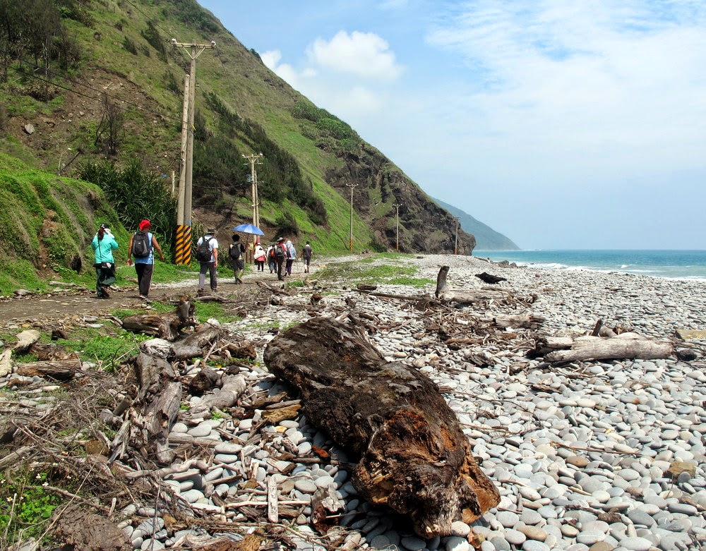
When the government announced plans to extend Highway 26 through this section of Taiwan's Pacific Coast (the project has since been cancelled), the public suddenly became aware of the Alangyi Ancient Trail (阿朗壹古道). This beachside track has since become a very popular hike, and the road-building project has been shelved. A quota of 300 people per day is imposed and permits (which must be obtained in advance at a cost of NTD150 per person) are carefully checked. We hiked from the southern end, near Xuhai (旭海) in Pingtung County. The first stretch of trail is a regular if narrow road from a small fishing harbor:
No part of the beach is sandy and in many places it's littered with driftwood.
For more photos, see Part 2 of this post.
Labels:
coast,
environment,
hiking,
Pingtung,
Taitung,
things that aren't in the guidebook
Wednesday, April 2, 2014
Taiwan's onion capital
It's onion-harvesting season in and around Checheng in Pingtung County (屏東縣車城鄉), a township many tourists pass through en route to Kenting National Park. In a few places, like the spot pictured, the smell of fresh onions is strong yet never overpowering.
Subscribe to:
Comments (Atom)


